In this topic, we continue our discussion of managing flood coverage on the XS Floodtab in Units At Risk.
You can use the XS Flood Detail tab to provide information about the property in relation to flood coverage.
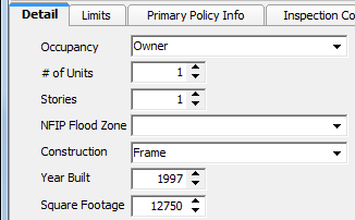
- On the
Detail tab, enter the following property information in the boxes provided.
- Occupancy – person that occupies the property
- # of Units – number of habitable units on the property
- Stories – number of stories on the property
- NFIP Flood Zone – National Flood Insurance Program (NFIP) flood zone ID code
- Construction – type of construction materials used to build the property
- Year Built – year in which the property was built
- Square Footage – square footage of the property
|
NFIP flood zones are maintained in the Lookup table of Data Maintenance Utility (DMU). The lookup code for flood zones is FZ. |
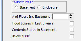
- In the Substructure pane, select the type of substructure that applies to the property, if applicable.
- Provide
the following information about the property in the boxes provided.
- # of Floors Incl Basement – number of floors on the property, including the basement, if applicable
- Flood Losses in Last 5 years – indicates whether the property has suffered flood losses within the last 5 years
- Contents Stored in Basement – indicates whether insured contents are located in the basement
- Below 1000' – indicates whether the property is below 1000 feet in elevation
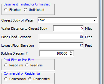
- In the Basement Finished or Unfinished pane, select whether the basement is finished or unfinished, if applicable.
- In the
following boxes, enter information about the property.
- Closest Body of Water – type of body of water nearest to the property
- Water Distance to Closest Body – distance to the nearest body of water in miles
- Base Flood ElIevation – flood elevation, in feet, for the area in which the property is located
- Lowest Floor Elevation – elevation of the property's lowest floor, in feet
- Building Diagram # – building diagram number
- In the
Post–Firm or Pre–Firm pane, select whether the property was built:
- Post–FIRM – after the effective date of the first Flood Insurance Rate Map (FIRM) for the community.
- Pre–FIRM – before the effective date of the first FIRM for the community.
|
The contents of the Closest Body of Water list are maintained in the Lookup table of DMU. The lookup code for the closest body of water is CBW. |
- In the Commercial or Residential pane, select one of the following options to indicate the type of property being covered.
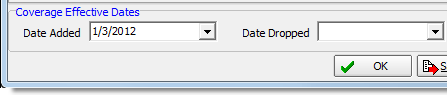
- In the
Coverage Effective Dates pane, enter the coverage effective dates, or
click
 to use the Calendar.
- Date Added – date on which the property was added to the policy
- Date Dropped – date on which the property was dropped from the policy